
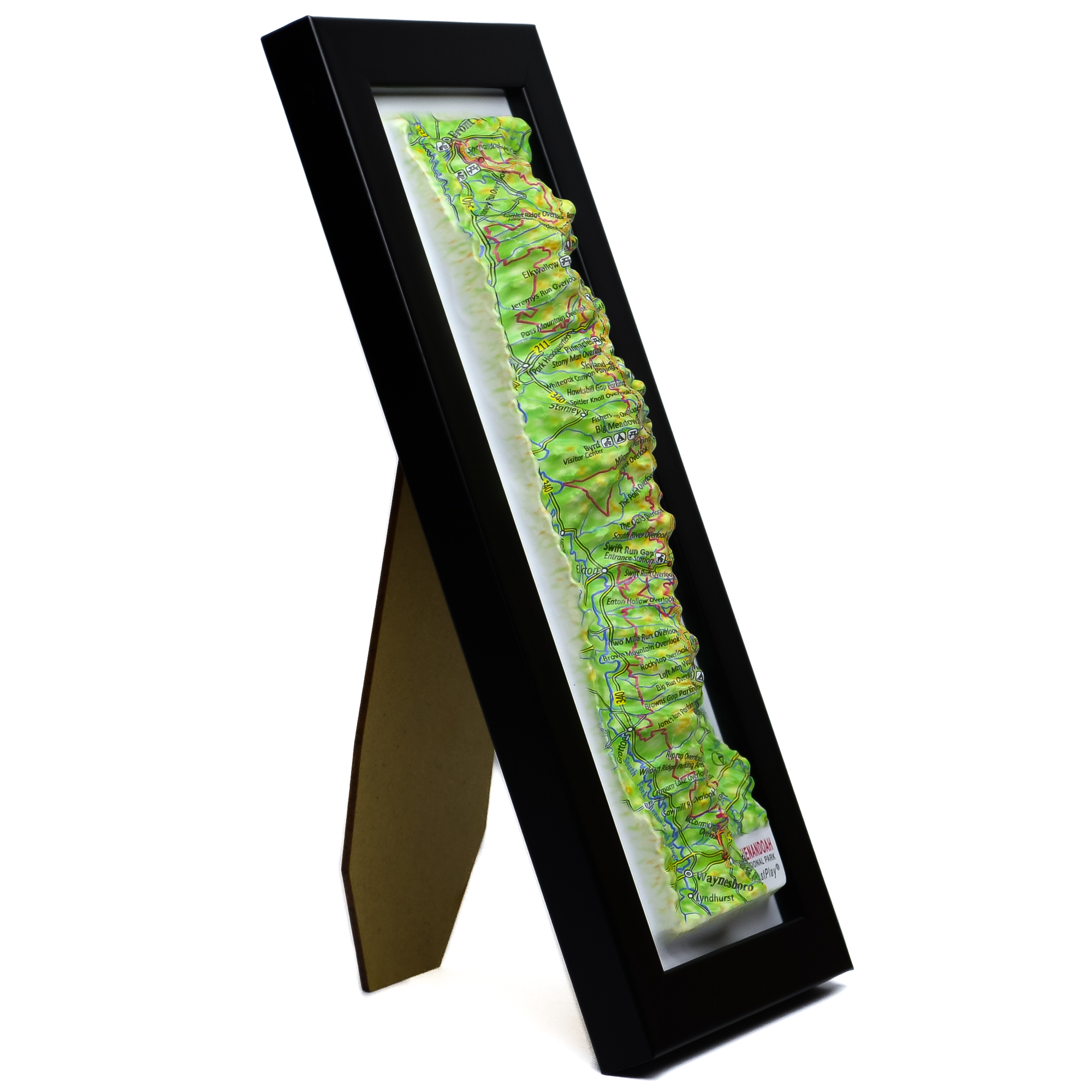
Shenandoah National Park 3D Map | Raised Relief Map by TestPlay
🔖 TestPlay’s 3D National Park Maps with a panoramic effect are masterpieces of miniature realism. This Shenandoah National Park 3D Map is a symphony of nature’s grandeur, bringing the breathtaking beauty of the Blue Ridge Mountains to life. It’s more than just a map; it’s a tangible piece of this sanctuary brought into your hands.
Product Specifications
This meticulously crafted Shenandoah National Park 3D Map brings the park to life with precise detail:
- Length: 7.5 inches (193 mm)
- Width: 2.75 inches (70 mm)
- 3D Relief Height: Up to 1.4 inches (35 mm)
- Map Scale: 1 inch = 11.25 Miles (1:715,000)
Price: $39.00
Interested in carrying TestPlay maps in your store?
We are open to wholesale partnerships worldwide. For cooperation inquiries, please contact us →


Discover Shenandoah National Park in 3D
Shenandoah National Park is a place where the Blue Ridge Mountains rise and fall like the breath of the earth itself. Here, the peaks stretch endlessly toward the heavens, their silhouettes softened by the embrace of mist and sunlight. Waterfalls cascade through ancient forests, their melodies mingling with the rustle of leaves and the gentle hum of life. The air is crisp, carrying the scent of pine and wildflowers, and every sunrise transforms the valleys into a canvas of golden light, as if the sky itself is pouring its heart into the land.
Skyline Drive, winding like a ribbon through the mountains, offers vistas that stir the soul, inviting you to pause and lose yourself in the vastness of it all. Shenandoah is more than a park it’s a sanctuary, a place where the wild heart of nature beats in harmony with your own, whispering stories of timeless beauty and quiet wonder.
Now, imagine holding that beauty in the palm of your hand. The 3D maps of Shenandoah National Park by TestPlayNA are not just models; they are miniature masterpieces, crafted with an artist’s touch and a lover’s devotion. Soft, natural colors bring the landscape to life, while intricate details of babbling rivers and rugged peaks evoke the very essence of the park. With a relief height of up to 1.4 inches (35 mm), you can trace the contours of Hawksbill Mountain, the park’s highest peak, and feel the grandeur of Skyline Drive as it winds through the Blue Ridge Mountains.
Why Choose TestPlay’s 3D National Park Maps?
TestPlay’s 3D National Park maps offer a clear bird’s-eye view of iconic protected landscapes. Each raised relief map accurately represents mountains, valleys, rivers, forests, trails, and elevation changes. These maps help you understand terrain, scale, and natural geography at a glance.
Designed for hikers, travelers, and nature lovers, these 3D topographic maps of national parks make landscapes easy to read and explore.
Perfect for trip planning, reliving past adventures, or appreciating national park landscapes.
The realistic relief and refined surface details make every park instantly recognizable.
Each national park 3D map is a conversation piece for sharing travel stories and planning future hikes.
With an elegant Art Deco–inspired design and a compact format, TestPlay’s 3D relief maps of national parks fit naturally into any interior. They complement homes, offices, lodges, visitor centers, schools, and hotels.
A meaningful gift for hikers, campers, travelers, and outdoor enthusiasts.
A Timeless National Park Keepsake
Each TestPlay 3D national park map is a lasting tribute to protected natural landscapes.
It reflects a personal connection to nature and a passion for exploration.
It is decor and a timeless souvenir connected to nature.
Contents of Available Now 3D Maps
List of National Parks 3D Maps
- Acadia National Park 3D Map
- Arches National Park 3D Map
- Cuyahoga Valley National Park 3D Map
- Glacier National Park 3D Map
- Grand Canyon National Park 3D Map
- Grand Teton National Park 3D Map
- Great Smoky Mountains National Park 3D Map
- Mount Rainier National Park 3D Map
- Olympic National Park 3D Map
- Rocky Mountain National Park 3D Map
- Yellowstone National Park 3D Map
- Yosemite National Park 3D Map
- Zion National Park 3D Map
List of Countries 3D Maps
List of States & Islands 3D Maps
List of Cities 3D Maps
List of Cities Mecca & Medina 3D Maps
List of 3D Ski Maps
- Alpine Meadows 3D Ski Map
- Alta 3D Ski Map
- Aspen Highlands 3D Ski Map
- Aspen Mountain 3D Ski Map
- Beaver Creek 3D Ski Map
- Big Sky 3D Ski Map
- Breckenridge 3D Ski Map
- Buttermilk 3D Ski Map
- Copper Mountain 3D Ski Map
- Deer Valley 3D Ski Map
- Heavenly 3D Ski Map
- Jackson Hole 3D Ski Map
- Keystone 3D Ski Map
- Killington 3D Ski Map
- Mammoth Mountain 3D Ski Map
- Northstar 3D Ski Map
- Okemo Mountain 3D Ski Map
- Palisades Tahoe 3D Ski Map
- Park City 3D Ski Map
- Powder Mountain 3D Ski Map
- Snowbird 3D Ski Map
- Snowmass 3D Ski Map
- Steamboat Springs 3D Ski Map
- Taos Ski Valley 3D Ski Map
- Telluride 3D Ski Map
- Vail 3D Ski Map
- Winter Park 3D Ski Map
Contents of Portfolio 3D Maps
List of Mini Format 3D Maps
- Austria 3D Map Mini
- China 3D Map Mini
- France 3D Map Mini
- Germany 3D Map Mini
- Greece 3D Map Mini
- Italy 3D Map Mini
- Kazakhstan 3D Map Mini
- Russia 3D Map Mini
- Scotland 3D Map Mini
- Switzerland 3D Map Mini
- United Kingdom 3D Map Mini
- Crete 3D Map Mini
- Le Grand Paris 3D Map Mini
- Moscow Oblast 3D Map Mini
- Colorado 3D Map Mini
- New York State 3D Map Mini
- Texas 3D Map Mini
- Washington 3D Map Mini
- London 3D Map Mini
- Los Angeles 3D Map Mini
- New York City 3D Map Mini
- San Francisco 3D Map Mini
- Sochi 3D Map Mini