
Le Grand Paris 3D Map Mini | Raised Relief Map by TestPlay | Portfolio
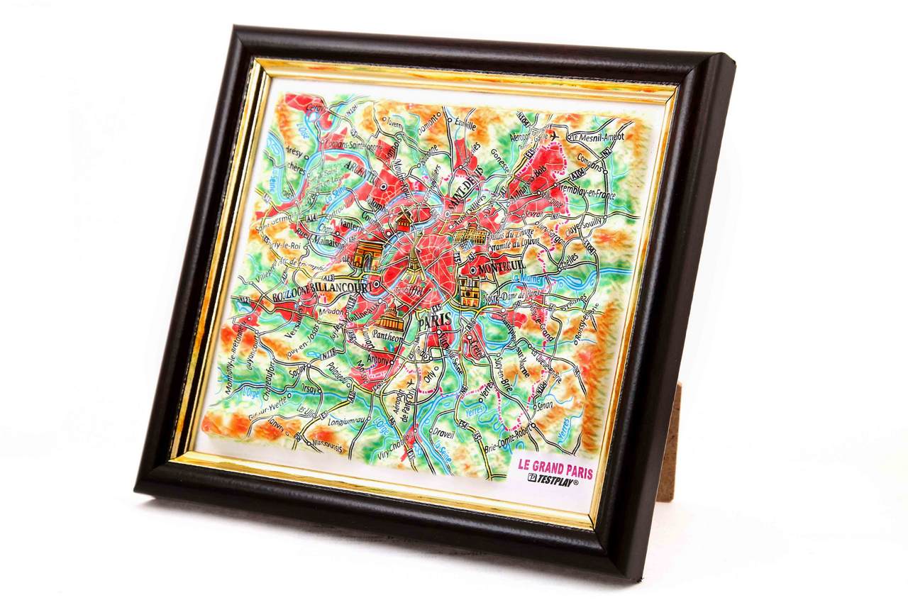
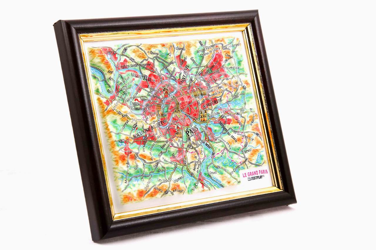
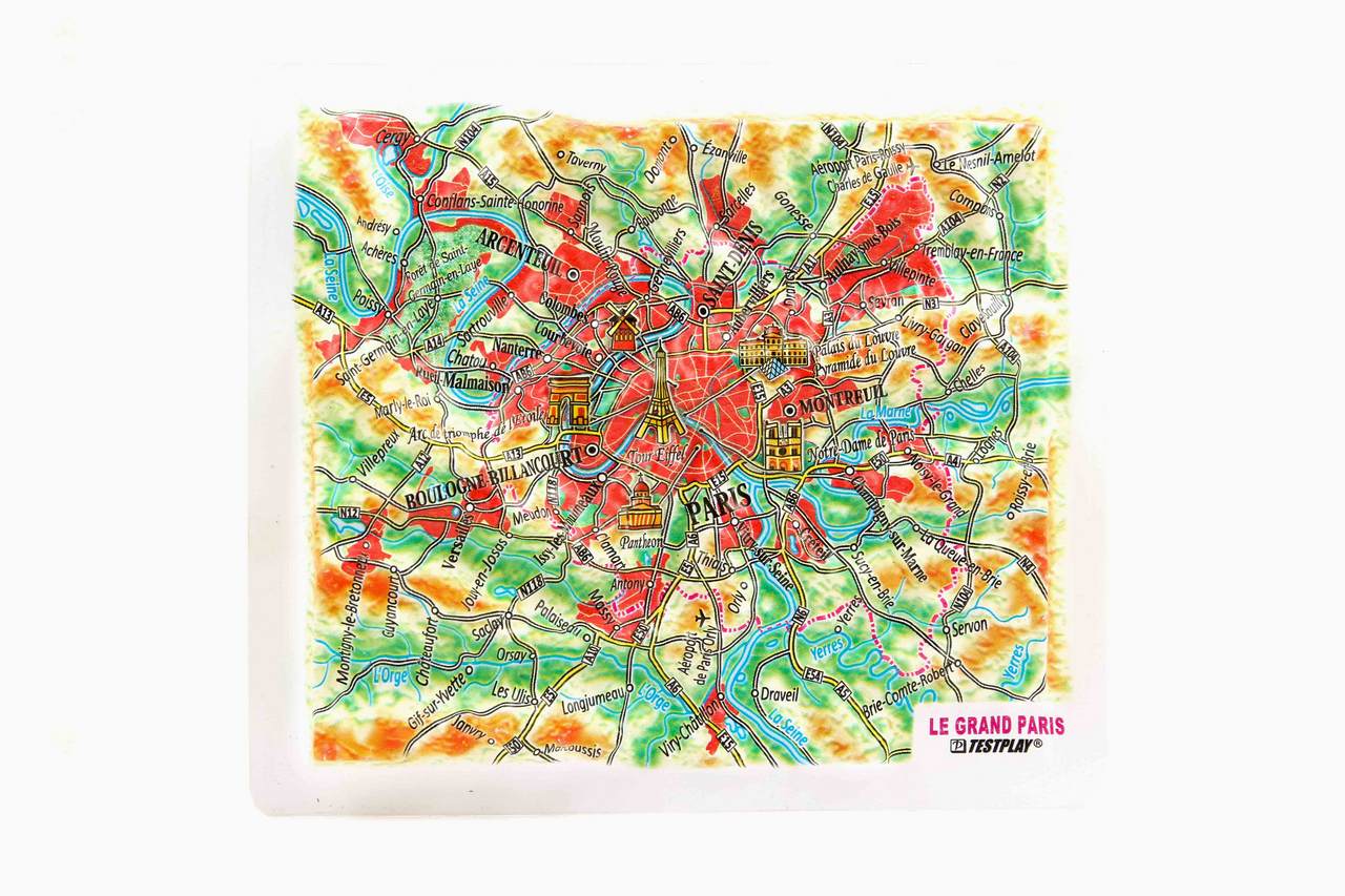
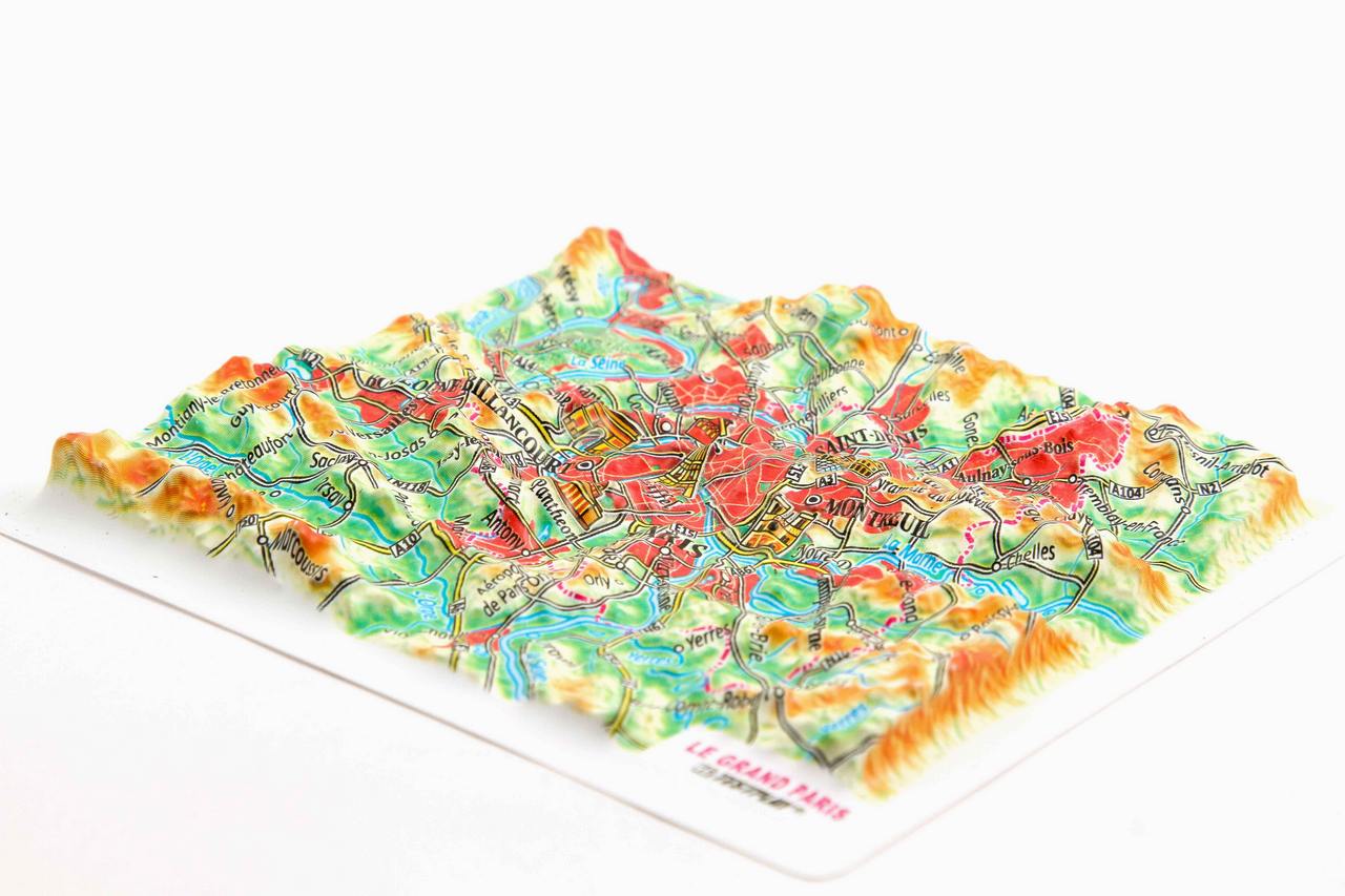
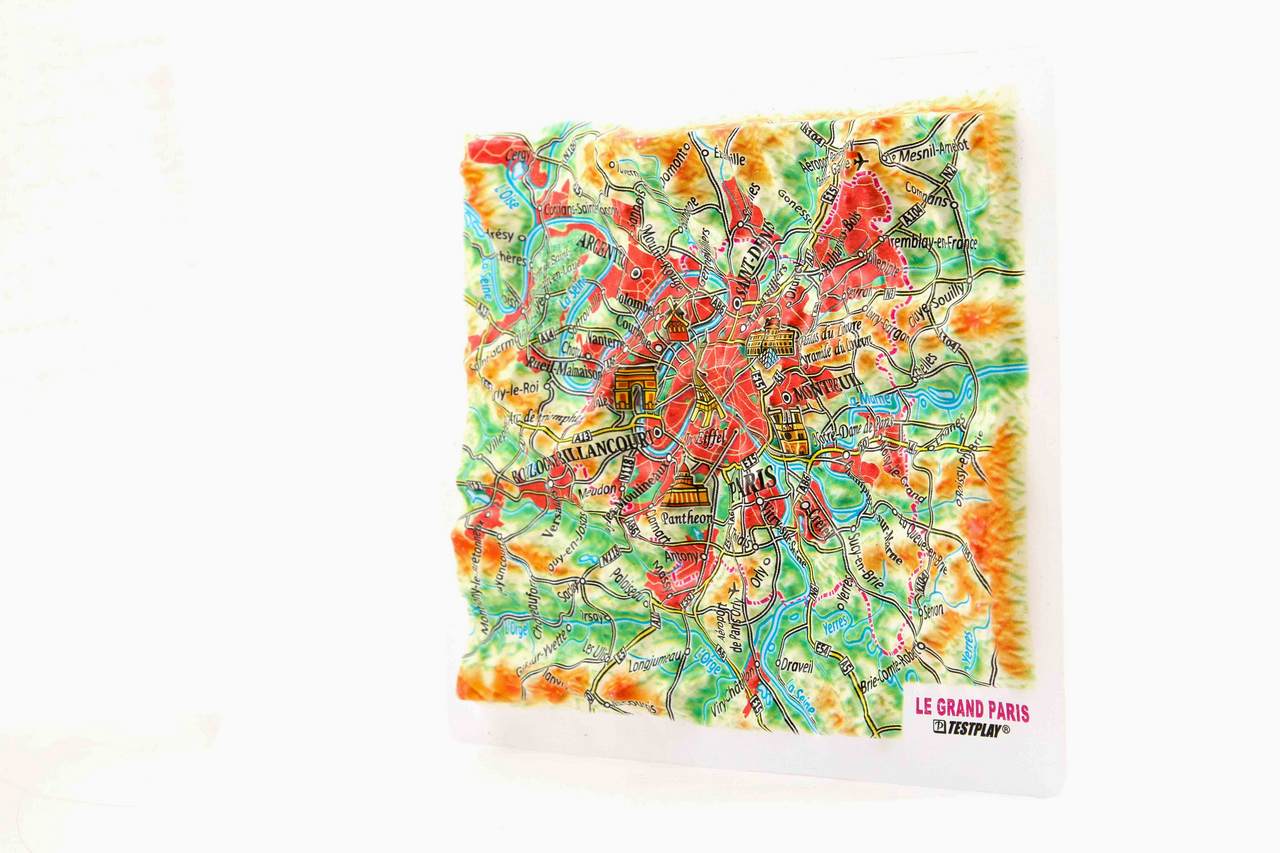
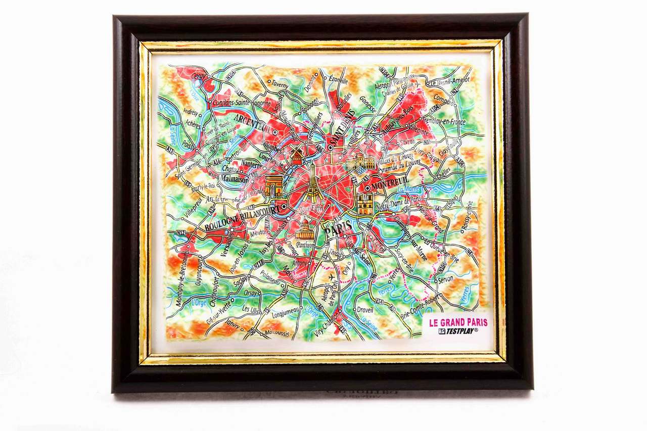
🔖 TestPlay’s mini 3D maps combine precise terrain modeling with a compact format designed for smaller spaces and close-up viewing. This Le Grand Paris 3D Map (Mini) presents the extended metropolitan area of Paris in clear raised relief, including surrounding territories that form Greater Paris. The map is enriched with graphical icons marking major landmarks such as the Eiffel Tower, Notre-Dame de Paris, the Panthéon, Arc de Triomphe, Moulin Rouge, and the Louvre complex. It also features key infrastructure, including major roads and the international airports of Paris-Orly and Paris–Charles de Gaulle. Small in size yet rich in detail, it offers an elegant and informative way to explore the structure and landmarks of the Paris region.
Product Specifications
This meticulously crafted Le Grand Paris 3D Map (Mini) brings the region to life with precise dimensional detail:
- Length: 4.6 inches (116 mm)
- Width: 5.2 inches (132 mm)
- 3D Relief Height: Up to 1.6 inches (40 mm)
- Map Scale: 1 inch = 7 miles (1:475,000)
- Map Language: French
Map labels are in French.
Contents of Available Now 3D Maps
List of National Parks 3D Maps
- Acadia National Park 3D Map
- Arches National Park 3D Map
- Cuyahoga Valley National Park 3D Map
- Glacier National Park 3D Map
- Grand Canyon National Park 3D Map
- Grand Teton National Park 3D Map
- Great Smoky Mountains National Park 3D Map
- Mount Rainier National Park 3D Map
- Olympic National Park 3D Map
- Rocky Mountain National Park 3D Map
- Shenandoah National Park 3D Map
- Yellowstone National Park 3D Map
- Yosemite National Park 3D Map
- Zion National Park 3D Map
List of Countries 3D Maps
List of States & Islands 3D Maps
List of Cities 3D Maps
List of Cities Mecca & Medina 3D Maps
List of 3D Ski Maps
- Alpine Meadows 3D Ski Map
- Alta 3D Ski Map
- Aspen Highlands 3D Ski Map
- Aspen Mountain 3D Ski Map
- Beaver Creek 3D Ski Map
- Big Sky 3D Ski Map
- Breckenridge 3D Ski Map
- Buttermilk 3D Ski Map
- Copper Mountain 3D Ski Map
- Deer Valley 3D Ski Map
- Heavenly 3D Ski Map
- Jackson Hole 3D Ski Map
- Keystone 3D Ski Map
- Killington 3D Ski Map
- Mammoth Mountain 3D Ski Map
- Northstar 3D Ski Map
- Okemo Mountain 3D Ski Map
- Palisades Tahoe 3D Ski Map
- Park City 3D Ski Map
- Powder Mountain 3D Ski Map
- Snowbird 3D Ski Map
- Snowmass 3D Ski Map
- Steamboat Springs 3D Ski Map
- Taos Ski Valley 3D Ski Map
- Telluride 3D Ski Map
- Vail 3D Ski Map
- Winter Park 3D Ski Map
Contents of Portfolio 3D Maps
List of Mini Format 3D Maps
- Austria 3D Map Mini
- China 3D Map Mini
- France 3D Map Mini
- Germany 3D Map Mini
- Greece 3D Map Mini
- Italy 3D Map Mini
- Kazakhstan 3D Map Mini
- Russia 3D Map Mini
- Scotland 3D Map Mini
- Switzerland 3D Map Mini
- United Kingdom 3D Map Mini
- Crete 3D Map Mini
- Moscow Oblast 3D Map Mini
- Colorado 3D Map Mini
- New York State 3D Map Mini
- Texas 3D Map Mini
- Washington 3D Map Mini
- London 3D Map Mini
- Los Angeles 3D Map Mini
- New York City 3D Map Mini
- San Francisco 3D Map Mini
- Sochi 3D Map Mini